Gjør som tusenvis av andre bokelskere
Abonner på vårt nyhetsbrev og få rabatter og inspirasjon til din neste leseopplevelse.
Ved å abonnere godtar du vår personvernerklæring.Du kan når som helst melde deg av våre nyhetsbrev.
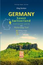
This is a book 7 in my new series of "Hiking Maps" for the most fairytale-like national parks in Germany - Saxon Switzerland National Park (Nationalpark Sächsische Schweiz) with bizarrely shaped ancient sandstone rocks and mountains covered with moss, lichen and ferns and surrounded by dense temperate forests with more than 400 km well maintained hiking trails. The book contains detailed 25 hiking maps, technical details for each trail (more than 56 trails) like distance (km and miles), hiking time, altitude elevation, gain and loss in altitude, visual altitude profiles, itinerary landmarks, itinerary pictures (100+ pics), camping sites, rock shelters (Boofen), caves, viewpoints, sightseeing, climbing rocks, restaurants, museums, with more than 50 web links. Firstly, it describes in very detail 7 most popular hikes in the park around famous Bastei Bridge and rocks, including Devil's Chamber Hike, Sweden Holes Hike, Stadt Wehlen - Kurort Rathen Hike, circular Hohnstein Trail and more. Then it shows 10 topo maps for most attractive sandstone rocks, table mountains in the park and around, depicting hiking trails, caves, some have beer and snack cafés on their top, climbing rocks, historical sites, metal and wood stairs, plus it describes how to get to them by train, bus, and ferry with ticket prices and ride duration. Then, the 3rd chapter shows 8 topo maps with a very famous and old Malerweg Trail (Malerweg Wanderweg, Trail of Painters), which traverses the most beautiful locations in the park and nearby with stunning landscapes and historical sites, consisting of a 8 stages (Etappe, in German), 8 days trekking circuit of moderate complexity. And, finally, at the end of the book I give information about the park itself, its history, geology, rules, and listing all 58 Boofen used by climbers. This collection of hiking maps is in color printed on high quality paper in a compact 6x9 in (15.2x22.8 cm), lightweight, robustly made book format, which can fit into any backpack and be easily used while you are hiking and during planning, researching your hikes. S U M M A R Y25 hiking maps, 56+ hiking trailsTrails have distance (km and miles), hiking time, altitude elevation, gain and loss in altitude, visual altitude profilesMaps show itinerary landmarks, camping sites, rock shelters (Boofen), caves, viewpoints, sightseeing, climbing rocks, restaurants, museums, historical sites, bus and train stops, ferry transport, 50 web links100+ itinerary most beautiful colorful picturesMalerweg trail with 8 stages (Etappe) of 120 km trekkingFull list of 58 Boofen (rock shelters) for climbersCompact 6x9 in (15.2x22.8 cm), lightweight, fully colorful inside, robustly made book with a glance cover
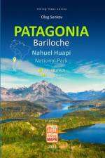
This is a book 6 in my new series of "Hiking Maps" for wonderful unearthly beautiful Patagonia, for its oldest national park Nahuel Huapi, of course, fully updated for 2023-24 seasons. The book contains detailed 14 hiking maps, technical details for each trail like distance (km and miles), hiking time, altitude elevation, gain and loss in altitude, visual altitude profiles, itinerary landmarks, free and paid camping sites, mountain huts (refugio), river crossing, bridges, lookouts (mirador), sightseeing. The book describes the major hiking trails (32+) in the park around San Carlos de Bariloche city, but also additional less-known trails and less crowded multi-day hikes at its most remote southern and northern parts of the park, plus, in the small Los Arrayanes National Park, a very popular tourist attraction for hiking in the ancient Arrayanes (Chilean myrtle tree) forest. I also give information on San Carlos de Bariloche city, camping sites, bus station, airport, then the park info, rules and prices, with 45+ useful web links and how to hike safely in Patagonia, art and skills in surviving harsh Patagonian conditions, especially in the Andes region, as a hiker.
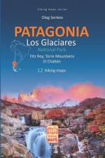
This is a book 5 in my new series of "Hiking Maps" for wonderful unearthly beautiful Patagonia, for its most famous national park Los Glaciares, of course, fully updated for 2023-24 seasons. The book contains detailed 12 hiking maps, technical details for each trail like distance (km and miles), hiking time, altitude elevation, gain and loss in altitude, visual altitude profiles, itinerary landmarks, free and paid camping sites, estancias, river fording. The book describes the major hiking trails in the park around the famous Fitz Roy and Torre mounts, but also additional less-known trails and less crowded multi-day hikes - among them: Laguna Túnel o Toro, Túnel Superior Hikes, Bahia de Hornos, de Los Tempanos Hikes. I also give information on the El Chaltén and El Calafate cities, camping sites, grocery shops, banks, bus station, bus routes and companies, then the park info, rules and prices, and how to hike safely in Patagonia, art and skills in surviving harsh Patagonian conditions, especially in the Andes region, as a hiker.
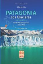
This is a book 4 in my new series of "Hiking Maps" for wonderful unearthly beautiful Patagonia, for its most famous national park Los Glaciares, of course, fully updated for 2023-24 seasons. The book contains detailed 14 hiking maps, technical details for each trail like distance (km and miles), hiking time, altitude elevation, gain and loss in altitude, visual altitude profiles, itinerary landmarks, free and paid camping sites, estancias. The book describes the major hiking trails in the park around the famous Perito Moreno Glacier, but also 7 additional less-known trails and less crowded, half-day, full-day and multi-day hikes - among them: Lago Roca hikes, Los Baguales hike, Cerro de los Cristales hike, Estancia la Usina hikes, Estancia Cristina hikes, Punta Walichu Caves with Paleolithic 4,000 years old paintings in sandstone rock from ancient Patagonian aborigine tribes of Tehuelche people, Laguna Nimez hikes in the birds nature reserve with flamingo rookery. I also give information on the El Calafate city, camping sites, grocery shops, banks, bus station, bus routes and companies, then the park info, rules and prices, and how to hike safely in Patagonia, art and skills in surviving harsh Patagonian conditions, especially in the Andes region, as a hiker.
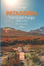
This is a book 3 in my new series of "Hiking Maps" for wonderful unearthly beautiful Patagonia, for its most famous national park located at the end of the world - Tierra del Fuego, of course, fully updated for 2023-24 seasons. The book contains detailed 30 hiking maps, technical details for each trail like distance (km and miles), hiking time, altitude elevation, gain and loss in altitude, visual altitude profiles, itinerary landmarks, free and paid camping sites, mountain huts. The book describes the major hiking trails in the park, in its borders, but also 11 additional less-known off-the park trails and less crowded, half-day, full-day and multi-day hikes - among them: 4 days Sierra Valdivieso Circuit, 5 days Beagle Channel Trail, and the southernmost trail in the world - 3-4 days Dientes de Navarino Trail (Chile). I also give information on the park info, rules and prices, and how to hike safely in Patagonia, art and skills in surviving harsh Patagonian conditions, especially in the Andes region, as a hiker.
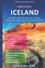
This is a unique and the most complete "smart" travel guide, which I made, at first, to be solely used in my own, after buying so many travel guides and still feeling - they aren't good enough for my adventures to explore wilderness as a biologist and wildlife, travel photographer. I was missing it during my 4 expeditions in ICELAND, otherwise, I would be much more efficient as a landscape/wildlife photographer and traveler. This is my 4th book in the "wilderness explorer" series. This "smart" travel guide contains 260 GPS coordinates of important to know places in ICELAND, 90 website links, covering: best viewpoints, 40 campsites with detailed info and prices, hiking trails around, The book first describes how to get to ICELAND with a ferry from Denmark or by air, then, how to commute within ICELAND with a bus, a rented car or hitchhiking, after that I give the most important advices how to survive as adventurous hiker, how to safely do multiday trekking in dangerous Highlands, and then finally, I review in detail 49 different key sights around ICELAND with 49 images: these are 17 waterfalls, 11 volcanoes, 4 mounts/rocks, 4 geothermal areas and geysers, 7 lakes/lagoons, and 6 cracks/canyons. The book can be equally useful for "budget" adventure seekers, solo, group travelers, in "fast & easy" style with a rented car, campers or travel agency users as well as for paid wildlife and travel, landscape photographers on a mission. I hope the book will be a good "practical tool", an all-to-know set of guidebooks for you (for me as well), while you are exploring the world with responsible mind and open heart as a truly nature lover.
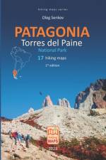
This is a book 2 in my new series of Hiking Maps for wonderful unearthly beautiful Patagonia, for its most famous national park - Torres del Paine, of course, fully updated for 2024 season. The book contains detailed 17 hiking topo maps, technical details for each trail (20+ trails) like distance (km and miles), hiking time, altitude elevation, gain and loss in altitude, visual altitude profiles, itinerary landmarks, camping sites, mountain huts, hostels, cabins, hotels, their prices, conditions and utilities. The book describes the major hiking trails (11 trails) in the park - "W" and "O" trek and circuit, but also 9 additional less-known trails off the beaten routes and less crowded, which do not require preliminary reservations (unlike "W" and "O" treks). I also give information how to hike safely in Patagonia, art and skills in surviving harsh Patagonian conditions, especially in the Andes region, as a hiker. This collection of hiking maps is in color printed on high quality paper in a compact 6x9 in (15.2x22.8 cm), lightweight, robustly made book format, which can fit into any backpack and be easily used while you are hiking and/or during planning, researching your hikes.
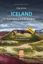
This is my new series of "Hiking Maps" for wonderful unearthly beautiful and rough ICELAND, its heart and soul, - volcanic Landmannalaugar region in Highlands, of course, fully updated for 2024 season. The book contains detailed 18 hiking maps, technical details for trails like distance (km and miles), hiking time, altitude elevation, gain and loss in altitude, visual altitude profiles, itinerary landmarks, complexity, GPS coordinates for major hiking trail marks, camping sites, mountain huts, their actual prices and conditions. The book also contains hiking maps for 2 famous multiday trekking routes - Laugavegur and Fimmvörðuháls Trails. I also give information how to hike safely in Iceland, art and skills in surviving harsh Icelandic conditions as a hiker. Plus, at the end of the book, there are many useful web links and a list of major campsites in Iceland and their prices, conditions and rules. This collection of hiking maps is in color printed on high quality paper in a compact 6x9 in (15.2x22.8 cm), lightweight, robustly made book format, which can fit into any backpack and be easily used while you are hiking and/or during planning/researching your hikes.
This is my 7th travel guide in the series "Wilderness Explorer", now for wonderful ICELAND, its Myvatn Lake area, of course, fully updated for 2022-2023 seasons. The book contains: in total - description of 23 tourist attractions around the lake, 12 near attractions (radius: 0-15 km) and 11 distant attractions (radius: 15-100 km), 30+ trails with technical info, information how to get to Iceland by plane or ferry, and how to get to each attraction either by public bus, car, bicycle or on foot, - plus, schedules, prices. I also review accommodation in details - camping sites, mountain huts, where to eat and shop, museums and exhibitions, bathing in hot springs, tour agencies, useful websites. Iceland has one of the most complex and dangerous terrains in the world and harsh unpredictable weather, to promote safe and happy travelling, I included in the book a big chapter on how to survive Iceland as a hiker, practical surviving art and skills, how to do short hikes and long trekking in Iceland safely. The guide also provides 100+ precise GPS coordinates for all attractions, viewpoints, trailheads, river crossings, campings, mountain huts, shops and restaurants, plus, it has 3 tourist attractions maps, 100+ web links, 29 beautiful photos. I do hope the book will be useful for any traveler on wheel or foot, hikers, digital nomads, adventure seekers, photographers and nature lovers, and will save you a lot of time, nerves and energy in researching your travel itinerary. Safe and happy travelling!
This is a unique and the most complete "smart" travel guide, which I made, at first, to be solely used in my own, after buying so many travel guides and still feeling - they aren't good enough for my adventures to explore wilderness as a biologist and wildlife/travel photographer. I was missing it during my trip to Patagonia in 2017, otherwise, I would be much more efficient as a wildlife photographer and traveler. This is my second book in the "wilderness explorer" series (first one I wrote about Peninsula Valdes, see it at 13 Amazon webstores: www.amazon.com/dp/B078RC9QC2), which I hope, will be a good "practical tool", an all-to-know set of guide books for you (for me as well), while you are exploring the world with responsible mind and open heart as a truly nature lover. The book contains 90 GPS coordinates of important to know places, 40 website links, covering all the important campsites, hotels, viewpoints, trails, key sightseeing, it has a detailed trekking map, and 14 photographs I made in March-April 2017. The book first describes how to get in/out the park, all park's updated rules and prices, then how to design your trekking route and how to book all accommodation in the park and nearby. In addition to popular "W" and "O" trekking circuits in the park, I give information about another 6 less-known, secret "off-the-bitten-pass" trails. I also give all the details for wild and paid camping, hotels, hostels, domes, cabins, food stores, roads conditions, travel scenarios, public buses, prices for touristic services, paid tours, wildlife safaris, fishing, kayaking, horseback riding. At the end of the guide, I give detailed information what kind of wild animals and where you can meet in the park (puma, condors, huemul, guanaco, fox) and their behavior. I also describe where you can find fossils from Jurassic Era of ichthyosaur, of a large prehistoric marine dolphin-like predator, or to see ancient cave paintings of indigenous tribes lived here 3000-8000 years ago. The book can be equally useful for "budget" adventure seekers, solo/group travelers, "fast & easy" with a rented car/campers or travel agency users as well as for paid wildlife and travel photographers on a mission.Printed versions of the book just went far beyond of my anticipations; quality is highest standard possible, they are rather small (15x23 cm), light-weight (only 150 g each), fully colorful inside with maps and GPS coordinates, pages are robustly made and glued, the cover is made of water-repellent paper, books are flexible, you can bend them, nothing will happen... though, they are ideal to put them into your backpack and use them while you travel through wonderful Patagonia... Enjoy and take care!
Abonner på vårt nyhetsbrev og få rabatter og inspirasjon til din neste leseopplevelse.
Ved å abonnere godtar du vår personvernerklæring.