Gjør som tusenvis av andre bokelskere
Abonner på vårt nyhetsbrev og få rabatter og inspirasjon til din neste leseopplevelse.
Ved å abonnere godtar du vår personvernerklæring.Du kan når som helst melde deg av våre nyhetsbrev.
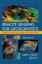
This book is an updated and expanded version of the existing text that explains what remote sensing is and how to use it in the earth sciences. It serves as a how-to guide and reference for those requiring remote sensing to assist with geologic mapping, landform analysis, petroleum and mineral exploration, groundwater development, civil engineer
This glossary offers approximately 20,000 English and Spanish translations of industrial terms from geology (petroleum, mining and remote, sensing), geography and other geotechnical fields. In addition, businesses and banking terms and phrases are included.
Abonner på vårt nyhetsbrev og få rabatter og inspirasjon til din neste leseopplevelse.
Ved å abonnere godtar du vår personvernerklæring.