

Gjør som tusenvis av andre bokelskere
Abonner på vårt nyhetsbrev og få rabatter og inspirasjon til din neste leseopplevelse.
Ved å abonnere godtar du vår personvernerklæring.Du kan når som helst melde deg av våre nyhetsbrev.
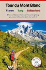
The world's most famous trek: everything you need to know to plan and walk the Tour du Mont Blanc which starts near Chamonix.
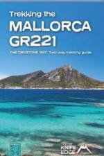
The definitive two-way guide to the Mallorca GR221 (the Drystone Way): both northbound and southbound routes are described in full.
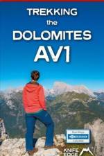
This is only guidebook exclusively for the AV1 and contains everything needed plan and walk Italy's most popular long-distance route. The guidebook contains real maps - Tabacco 1:25,000 - the finest maps available for the Dolomites, thus making navigation easy with no need to carry additional maps.
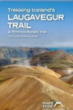
The definitive two-way guide to Iceland's Laugavegur Trail (& Fimmvörðuháls Trail): both southbound and northbound routes are described in full.Real Maps: full mapping inside (1:40,000), made specifically for the treks by Knife Edge Outdoor Guidebooks. All accommodation/campsites are numbered and marked on the maps.14 different itineraries: schedules of 2, 3, 4, 5, 6 and 7 days for hikers and runners. Includes both southbound and northbound itineraries. Difficult calculations of time, distance and altitude gain/loss are done for you.Also includes:Detailed information on equipment and travelling lightFull accommodation/campsite listingsEverything the trekker needs to know: route, costs, difficulty, weather and moreTravel to the trail-headEssential info for both self-guided and guided trekkersInformation on the volcanic sights along the routeInformation on plants and wildlifeHistory of IcelandNumbered waypoints linking the Real Maps to our clear descriptions
This definitive two-way guide to the Hadrian's Wall Path contains real OS mapping at 1:25,000 and both eastbound and westbound routes are described in full. There are 14 different itineraries with schedules of 3, 4, 5, 6, 7, 8 and 9 days for walkers and runners. Difficult calculations of time, distance and altitude gain are done for you.
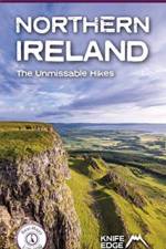
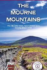
Discover Northern Ireland's wild mountains, epic cliffs, spectacular beaches and stunning moorland in this, the definitive guidebook for walking in Northern Ireland, It contains 35 epic walks, hand-picked by a Country Down local, including the Causeway Coast, the Glens of Antrim, the Mourne Mountains, the Sperrin Mountains and much more.
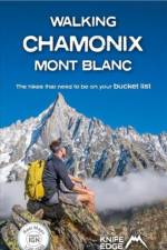
Only the most epic walks in the Chamonix Valley are included in this walking guide. Each walk has been carefully selected to enable easy access by public transport, including the Chamonix Valley's incredible cable car network.
- The only two-way guidebook to the GR20: both northbound and southbound routes are described in full. - Real IGN Maps included (1:25,000): no need to carry separate maps. - 15 different itineraries. Includes both northbound and southbound itineraries. Difficult calculations of time, distance and altitude gain are done for you.
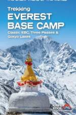
The definitive guidebook for trekking in the Everest Region: essential reading for both guided and self-guided trekkers. This book really knocks the ball out of the park. It fully describes the Classic Everest Base Camp Trek, 3-Passes Trek, Gokyo Lakes & 7 other incredible treks. It contains all the information you need to plan and execute your trek including: - How to organise a trek in the Everest region: booking a guided trip, independent trekking (which is still permitted around Everest), guides & porters. - Detailed advice on choice of trek: 29 different itineraries. - Altitude acclimatisation: how to avoid altitude sickness (AMS). - Travel to the trail-heads: air travel & hiking into the Everest region. - What equipment you need to bring. - What to expect on the trail: accommodation, food & daily routine. The book is also packed full of information that you will not find in any other guide: - Orientation charts show exactly which peaks are visible from each significant viewpoint: it is a trip of a lifetime so we want you to know exactly what you will see from each viewpoint. - 1:40,000 scale mapping: the most detailed mapping available for the Everest region: all villages and accommodation locations are marked on the maps. - Detailed sections on Buddhist monuments and Sherpa culture. - Detailed information on Yetis.
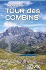
The definitive guidebook for the Tour des Combins: the new bucket list trek in the Swiss/Italian Alps. A superb alternative to the more famous Tour du Mont Blanc. Two-way guide: both clockwise and anti-clockwise routes are described in full. Real Maps: full mapping inside (1:40,000), made specifically for Knife Edge Outdoor Guidebooks. All accommodation/campsites are numbered and marked on the maps. 10 different itineraries: schedules of 6, 7, 8 and 9 days for hikers and runners. Includes both clockwise and anti-clockwise itineraries. Difficult calculations of time, distance and altitude gain/loss are done for you. Also includes: - Detailed information on equipment and travelling light - Full accommodation/campsite listings - Wild camping rules explained - Everything the trekker needs to know: route, costs, difficulty, weather and more - Travel to the trail-head - Essential info for both self-guided and guided trekkers - Information on plants and wildlife - Numbered waypoints linking the Real Maps to our clear descriptions The Tour des Combins is an epic trek in the Swiss and Italian Alps. It traverses some of Europe's wildest mountain terrain. The sublime scenery makes it a worthy alternative to the more famous Tour du Mont Blanc (which is only a stone's throw away). Hike along the edge of the Corbassière Glacier, one of the longest in Europe. Enjoy snow frosted summits, magnificent valleys and pastures, sparkling azure lakes, carpets of wild flowers, the soothing sound of cow bells and easy to follow paths. Stay in spectacularly situated villages and remote mountain huts. This will be a trip that you will never forget.
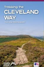
The definitive two-way guide to the Cleveland Way, one of England's epic National Trails: both eastbound and westbound routes are described in full. Real Maps: Full Ordnance Survey mapping inside (1:25,000). All accommodation is numbered and marked on the maps. 20 different itineraries: schedules of 5, 6, 7, 8, 9, 10 and 11 days for hikers and runners. Includes both eastbound and westbound itineraries. Difficult calculations of time, distance and altitude gain/loss are done for you. Also includes: - Detailed information on equipment and travelling light - Full accommodation listings: the best pubs, B&Bs and hotels - Detailed section on camping, including wild camping - Everything the trekker needs to know: route, costs, difficulty, weather, travel, and more - Essential info for both self-guided and guided trekkers - Information on plants and wildlife - Numbered waypoints linking the Real Maps to our clear descriptions Yorkshire's Cleveland Way is one of the most beautiful long-distance walking routes in Britain. It is one of England's official 'National Trails'. The route circumnavigates the spectacular North York Moors National Park. It explores both the evocative expanses of Yorkshire's famous heather moorland and the never-ending cliffs of its coastline. This is England at its best and it will be an adventure that you will never forget.
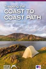
The definitive two-way guide to the Coast to Coast Path: both eastbound and westbound routes are described in full.Real Maps: Full Ordnance Survey mapping inside (1:25,000). All accommodation is numbered and marked on the maps.19 different itineraries: schedules of 11, 12, 13, 14, 15, 16, 17, 18 and 19 days for hikers and runners. Includes both eastbound and westbound itineraries. Difficult calculations of time, distance and altitude gain/loss are done for you.Also includes:Detailed information on equipment and travelling lightFull accommodation listings: the best pubs, B&Bs and hotelsDetailed section on camping, including wild campingEverything the trekker needs to know: route, costs, difficulty, weather, travel, and moreEssential info for both self-guided and guided trekkersInformation on plants and wildlifeNumbered waypoints linking the Real Maps to our clear descriptions
The definitive two-way guide to the West Highland Way: both northbound and southbound routes are described in full. Real Maps: Full Ordnance Survey Explorer mapping inside (1:25,000)
A collection of epic long-distance routes for walkers and runners in the Mournes, Northern Ireland's highest mountains with real OS Northern Ireland mapping.
Definitive two-way guide to the South Downs Way with westbound and eastbound routes described in full. Contains full Ordnance Survey Explorer mapping inside (1:25,000) and has 18 different itineraries for walkers and runners. Difficult calculations of time, distance and altitude gain are done for you.
Brittany's coastline has 3,000 km of sea frontage - plenty of spectacular and seemingly endless cliffs, remote rocky headlands and peninsulas and innumerable white sand beaches The guidebook includes Real IGN maps (1:25,000), numbered waypoints linking the Real maps to the book's clear descriptions and graded routes to suit all abilities.
These 30 epic walks in Northern Ireland's highest mountains have been handpicked and clearly written by a local walker with decades of experience. This is the only guidebook for the Mourne Mountains with REAL OSNI 1:25000 maps.
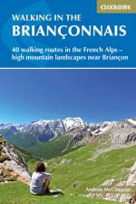
Guidebook of 40 walks around Briancon in France. Walks for all abilities ranging from 11/2 to 7hrs. The book focuses on the stunning valleys of Claree, Cerveyrette, Ayes, Durance and Guisane, and includes the magnificent Alpine landscapes around Vallouise and Montgenevre.
Abonner på vårt nyhetsbrev og få rabatter og inspirasjon til din neste leseopplevelse.
Ved å abonnere godtar du vår personvernerklæring.