


Gjør som tusenvis av andre bokelskere
Abonner på vårt nyhetsbrev og få rabatter og inspirasjon til din neste leseopplevelse.
Ved å abonnere godtar du vår personvernerklæring.Du kan når som helst melde deg av våre nyhetsbrev.
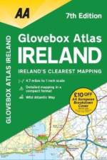
New edition, fully updated. Handy A5 format to fit in the glovebox of your car. Fast reference map grid and Irish grid references. Detailed road network of the whole of Ireland.
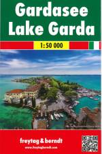
Falset kort i målestokken 1:50.00. Kortet er indsat i et papomslag sammen med en engelsk/tysk/italiensk miniguide på 78 sider. Guiden indeholder tegnforklaring, register, en kort beskrivelse af de største seværdigheder og forslag til udflugter og vandreture i området. Derudover er der bykort over: Riva del Garda, Sirmione og Verona.
Falset landkort i målestokken 1:30.000 med turistinformationer, indsat bykort, havneanlæg, samt register.
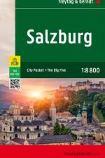
Falset bykort over Salzburg i målestokken 1:10.000. Kortet er trykt på lamineret papir og har masser af turistinformation og register trykt på bagsiden af kortet.
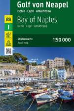
Falset kort over Napolibugten samt Amalfikysten fra Bacoli til Minori. Kortet indeholder også bykort og vandreruter.
The only guide to London's literary landmarks is updated for this new edition
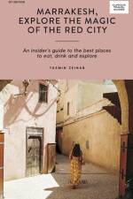
An insider's guide to the best places to eat, drink and explore in Marrakesh
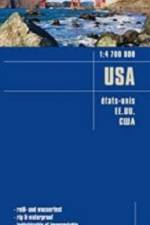
Falset landkort trykt på vejrbestandigt plastpapir (PolyArt - miljøvenligt) med papomslag. Brugervenligt og fuldt opdateret kort, ideelt for planlægning og rejsebrug.GPS-egnet Udførligt registerHøjdekurver med angivelse i meterSeværdighederAfstande i kmCampingpladser80 gramDobbeltsidet 70x100 cmMålestok 1:4.700.0001. udgave 2015
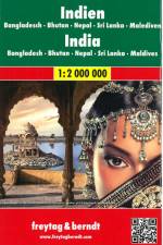
Falset kort i målestokken 1:2.000.000 med afstandsangivelser i km. Indsat hæfte med register og bykort over Delhi 1:18.000, Chennai (Madras) 1:16.000, Colombo 1:15.000, Kolkata 1:16.000 og Mumbai 1:16.000.
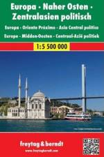
Explore Europe, the Middle East and Central Asia with this Freytag & Berndt road map. The best way to plan your trip, prepare your itinerary, and to travel independently in this country. Scale 1:5.5 mill. One side is the detailed map of these areas, and the other side is a full index for this map. Touristic information on the map include: Places of interestAirports, castles & antique sitesWorld Heritage sites
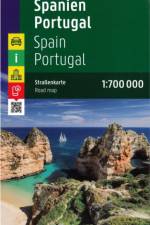
Falset kort i målestokken 1:700.000. Turistkort med mange praktiske informationer. Seværdigheder, campingpladser, vejbeskaffenhed, bykort og omfangsrigt stednavneregister.
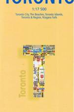
Lamineret kort over Toronto. Man kan skrive på kortet med vandfast tusch, og viske det ud igen, det bliver ikke vådt i regnvejr, og går ikke i stykker i sammenfoldningerne. Selve kortet indeholder blandt andet Niagara Falls, kort over Subway''en, Toronto City, Toronto Islands, Toronto & Region samt diverse turistinformationersom steder af interesse, monumenter, kirker, teatre, parker og meget mere..
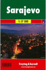
Falset bykort i målestokken 1:17.500 med vejnavneregister, områdekort og et indsat centrumskort i bedre målestoksforhold 1:6.000.
This book has been considered by academicians and scholars of great significance and value to literature. This forms a part of the knowledge base for future generations. So that the book is never forgotten we have represented this book in a print format as the same form as it was originally first published. Hence any marks or annotations seen are left intentionally to preserve its true nature.
This book has been considered by academicians and scholars of great significance and value to literature. This forms a part of the knowledge base for future generations. So that the book is never forgotten we have represented this book in a print format as the same form as it was originally first published. Hence any marks or annotations seen are left intentionally to preserve its true nature.
All the practical advice you need including getting around and where to stay plus a transport mapTen must-see sightsThemed walks Paris in 3 days plus day trips close to the cityParis on a budge
All the practical advice you need including getting around and where to stay plus a transport mapTen must-see sightsThemed walks Rome in 3 days plus day trips close to the cityRome on a budge
This pocket guide to highlights of modern and contemporary architecture in New York City features entries for 85 famous skyscrapers and cutting-edge projects.
A handy pocket-sized guide to the best food, drink and sights to see in Lisbon
This book has been considered by academicians and scholars of great significance and value to literature. This forms a part of the knowledge base for future generations. So that the book is never forgotten we have represented this book in a print format as the same form as it was originally first published. Hence any marks or annotations seen are left intentionally to preserve its true nature.
This book has been considered by academicians and scholars of great significance and value to literature. This forms a part of the knowledge base for future generations. So that the book is never forgotten we have represented this book in a print format as the same form as it was originally first published. Hence any marks or annotations seen are left intentionally to preserve its true nature.
This book has been considered by academicians and scholars of great significance and value to literature. This forms a part of the knowledge base for future generations. So that the book is never forgotten we have represented this book in a print format as the same form as it was originally first published. Hence any marks or annotations seen are left intentionally to preserve its true nature.
This book has been considered by academicians and scholars of great significance and value to literature. This forms a part of the knowledge base for future generations. So that the book is never forgotten we have represented this book in a print format as the same form as it was originally first published. Hence any marks or annotations seen are left intentionally to preserve its true nature.
This book has been considered by academicians and scholars of great significance and value to literature. This forms a part of the knowledge base for future generations. So that the book is never forgotten we have represented this book in a print format as the same form as it was originally first published. Hence any marks or annotations seen are left intentionally to preserve its true nature.
This book has been considered by academicians and scholars of great significance and value to literature. This forms a part of the knowledge base for future generations. We have represented this book in the same form as it was first published. Hence any marks seen are left intentionally to preserve its true nature.
This book has been considered by academicians and scholars of great significance and value to literature. This forms a part of the knowledge base for future generations. We have represented this book in the same form as it was first published. Hence any marks seen are left intentionally to preserve its true nature.
This book has been considered by academicians and scholars of great significance and value to literature. This forms a part of the knowledge base for future generations. We have represented this book in the same form as it was first published. Hence any marks seen are left intentionally to preserve its true nature.
This book has been considered by academicians and scholars of great significance and value to literature. This forms a part of the knowledge base for future generations. We have represented this book in the same form as it was first published. Hence any marks seen are left intentionally to preserve its true nature.
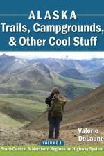
This quick-reference print book is organized by highway/road. You can find trails and public campgrounds based on where you are planning on traveling, rather than finding a trail on the internet and having to figure out where it's located, and then trying to figure out what else might be nearby. In addition to trails and campgrounds, you'll also find information on downhill and cross-country ski areas, biking trails, visitor centers/ranger stations, public use cabins, hut systems, boat launches, river float trips, rest stops, and hostels. You'll know where to get gas in remote locations, and where to take showers and dump RV tanks. Symbols are used so you can get information at a glance. Hikers sometimes ask: "Isn't this all on the internet?" The answer is that much of it is, but aside from much of it being incorrect, it's not organized/synthesized by location. This book was written because of sketchy information "out there" on the internet and other sources. Often the directions to the trailhead are incorrect, poor, or non-existent. The author found and verified directions, and checked basic information such as distances, elevation gains, and routes. Some websites claim to have people verifying their information, but one website actually maps the trail going 6.1 miles in the exact opposite direction of the actual trail! Once a single website gets the information incorrect, it propagates - for example, multiple websites had Curry Ridge Trail and K'esugi Ridge Trail as the same trail with interchangeable names, when in fact they are two separate and unconnected trails (as of 2019). So much information is incorrect (even from government agencies), that trails must be hiked with a GPS to verify information.
Abonner på vårt nyhetsbrev og få rabatter og inspirasjon til din neste leseopplevelse.
Ved å abonnere godtar du vår personvernerklæring.